July 29, 2011
I first heard of the Pittsford Ice caves when I was a teen and had always wanted to explore them. In January of 2008 my lifelong friend Jeff and I set out to find them with a GPS and a Geo-cache coordinate. We followed a straight line only to find ourselves 100 feet above the ravine that they lay in. We ended up meandering around and located the entrance. Unfortunately that day there was too much ice covering the access ladder that brings you down into the main rooms. Since then, I have been to these caves many times in different conditions. This recent trip was the second time this year that I visited them. The first time this year the caves were not quite explorable due to ice. This was in May... specifically Mothers Day.
Sunday, August 28, 2011
Friday, August 19, 2011
LT Thru-hike: Postponed
Life is a series of moments and events that although even with the best planning, routines etc, can change unexpectedly. These moments need to be prioritized. Being ready and with 12 days to go before my scheduled LT thru-hike I regretfully have to announce that due to some recent personal events in my life that need to be taken care of as a top priority, I have no choice but to postpone it some. It sucks because I have been planning and training for over a year and I'm ready to go but something came up that I need to take care of before I can do this glorious hike. I am hoping that it wont be postponed for too long... a few weeks maybe? I'm really unsure at this moment but I will not start the hike after October 1st either... It will have to wait until next year. The trail will still be there and so will I.

I will have some time to do some day hiking in the stead and possibly a night or two out but I can't go on a thru-hike for a month's time until I know I can go comfortably and know that all is taken care of. What's the saying? "C'est la vie"
:~)
Sunday, August 14, 2011
Southern Presidentials: Mt Washington to Crawford Notch
August 12, 2011
After an informative shuttle ride to the summit we strapped on our packs, donned our rain and wind shells and started our trek down Crawford Path: The oldest continuously-used mountain trail in America. It was 12:00pm.
As soon as we started, Jim slipped. Nothing major but he pointed out that there were some icy spots that weren't quite visible. It was going to be a slow day. It really didn't take us too long before we reached the junction of Westside trail. It seems we would average about a mile an hour. We continued on southerly as the clouds shifted.

They got thick then thinnd out some only to get thick again. I asked a north bound day hiker when we would be out of the clouds. His response was "the parking lot". We journeyed on and before we knew it, we were at Lakes of the Clouds hut. This is the only hut that is above 5000 feet.
 |
| Tuckerman Ravine engulfed in clouds |
This was a continuation completion of a Presidential mountain range traverse that my friend Jim and I started in June but ended with a bail out. We decide to do this in a day hike by starting out at Mt Washington and hike to Crawford Notch while bagging what peaks we could along the way. Our hiking friends Kathi and Deb joined us.
We took a shuttle up the Auto Road to the summit of Washington to start our days journey. The weather at the summit was completely different than in the valley. It was socked in with clouds, visibility was down to 30 yards, the winds were steady at 33 miles per hour, the temperature was 44 degrees with a wind chill of 30. But this was only at the summit. I was almost sure that once we dropped 1000 feet then we would be out of the clouds and be able to get some nice views. That wasn't the case.
 |
| Coming off Mt Washington |
As soon as we started, Jim slipped. Nothing major but he pointed out that there were some icy spots that weren't quite visible. It was going to be a slow day. It really didn't take us too long before we reached the junction of Westside trail. It seems we would average about a mile an hour. We continued on southerly as the clouds shifted.

They got thick then thinnd out some only to get thick again. I asked a north bound day hiker when we would be out of the clouds. His response was "the parking lot". We journeyed on and before we knew it, we were at Lakes of the Clouds hut. This is the only hut that is above 5000 feet.
 |
| Lakes of the Clouds |
 |
| Lakes of the Clouds hut |
We took a short break at the hut so we could strip some layers in a dry environment. We had already descended 1200 feet so it was much warmer. The place was packed. We trekked along to our next junction that would lead us to Mt Monroe. This loop trail meanders up a rocky steep cairn to cairn path to a false summit the over to the peak. At 1:16pm we bagged our highest mountain of the day: Mt Monroe 5372 feet above sea level.
 |
| Mt Monroe |
We didn't stay too long because we still had a long journey ahead of us and within a few minutes we were at 5001 foot, Mt Franklin. Although part of the Presidential range it was named after Benjamin Franklin and with a prominence of 49 feet it is not considered a 5000 footer. We continued on towards our next mountain with no signs of the clouds lifting or dissipating. Even though the temps were warmer the wind was still stiff and the viability was low. Soon we were at the Eisenhower loop trail. I love this loop trail. It is rugged, steep and loaded with switchbacks.
 |
| Climbing Mt Eisenhower |
At 2:53pm, we got to the 4760 foot top and were greeted by a large cairn and a few others who were day hiking. It was windy and cloudy. This summit is not like the other Presidents. It is round and doesn't have a pointy prominence.
 |
| Mt Eisenhower |
At 3 hours in and less than half way to go for the day we continued on towards our next mountain. We trekked down Eisenhower Loop trail to the junction of Crawford Path where we took a short break. The clouds were not as thick and it was getting warmer. Once we hiked on we finally got a glimpse of blue sky and the trail kept descending. As a bonus we were still in an alpine zone well above the tree line. Mt Pierce could be seen in the distance.
 | ||
| Mt Pierce |
As we descended more, it got much clearer. The views were amazing but the wind was still up there. I looked back and could see our hour past engulfed in clouds.
 | ||
| Mt Eisenhower. The Crawford Path meanders along this ridge. |
Between Mt's Pierce and Eisenhower
 |
| The views were awesome |
We finally were out of the clouds and took a short break to get rid of our shells and refuel some before dropping below the tree line. It didn't take us too long and we were at the junction to Mitzpah hut trail. which leads to the summit of Mt Pierce. Jim and Kathi decided to bag it while Deb and I continued descending down Crawford Path and entering the trees. I chose not to bag this peek due to the intimidation of the trail. It scrambled up and I was getting tired and sore. I will bag it next year. Within 15 minutes Jim and Kathi caught up to us. I didn't realize that it was such a short distance to the summit and regret not bagging it.
 |
| Kathi and Jim coming down Crawford Path |
The rest of the hike was on familiar terrain as we descended down towards Crawford Notch. Classic roots and rocks that we were all too fond of. We made pretty good time stopping at Gibbs Falls along the way.
 | |
| Gibbs Falls |
From the falls it was a 15 minute jaunt to the Mt Clinton parking lot where we parked. After 8.1 miles and 6 hours and 42 minutes later, our day was over.
 |
| The end of the day |
This trip was awesome. Although we were in the clouds for most of the high stuff we were lucky enough to get some good views. Jim and I both agreed that this hike was much easier than our adventure in June due to the fact we weren't carrying backpacks. My first Presidential Traverse is now complete even though it was done in two trips. Congratulations to Kathi and Deb who got the opportunity to bag their first 5000 footer and trek above the trees. I'm already looking forward to next years hut to hut traverse with Jim.
:~)
Thursday, August 11, 2011
Long Trail, Division 5
August 5-7, 2011
Day one: 7.3 miles
The weather was partly sunny warm in the 70's and humid. 3 of us; Allison aka Land Shark, Kathy and myself along with Prickles hit the trail at Rt 140 at 10:40 am.
Within 5 minutes we came to the main parking lot where a 4th met us, Sue. We left the parking lot and meandered up and over Bear Mt (there are 11 Bear Mountains in Vermont, 2 in Rutland County alone) After 2 hours and 3.6 miles in we reached our first stop for lunch at Minerva Hinchey shelter.
From the river the trail crosses Rt 103 and follows a boulder filled ravine. This was cut about 15 years ago. Sue recommended that we take the original trail at Crown Point Rd. This is a lot easier than the new path. Within 20 minutes we reached our days end at Clarendon shelter.
When we crossed 103 we ran into a couple of thru-hikers that we had met at Minerva Hinchey shelter. They took the new trail and after a short break when we reached Clarendon shelter the two men strolled down the spur and noticed us with a surprised look . A "when did they pass us?" look. While we were setting up camp, Wayne aka Mad Hatter, the Killington section's president came strolling down the trail. He was to join us for the remainder of the weekend.

 |
| Prickles |
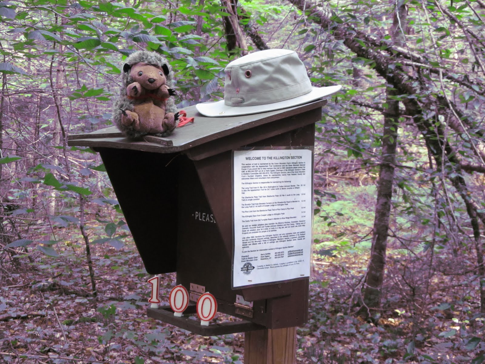
In 1910 the Green Mountain Club formed to start cutting a "footpath in the wilderness"; a trail that followed the spine of the Green Mountains of Vermont known as The Long Trail. In 1911, the club's first section formed; The Killington section; a group of 25 individuals who took on building a 24 mile stretch of trail that runs from Rt 140 in Wallingford to Rt 4 at Sherburne Pass.100 years later the Section scheduled a north bound "thru-hike" of this division. Last year was the GMC's centennial year and they hosted a relay thru-hike. As a special guest on our section hike we brought along the baton from the relay otherwise known as Prickles Porcupine.
Day one: 7.3 miles
The weather was partly sunny warm in the 70's and humid. 3 of us; Allison aka Land Shark, Kathy and myself along with Prickles hit the trail at Rt 140 at 10:40 am.
 |
| Allison holding Prickles, Kathi and me |
 |
| The start of our weekend |
Within 5 minutes we came to the main parking lot where a 4th met us, Sue. We left the parking lot and meandered up and over Bear Mt (there are 11 Bear Mountains in Vermont, 2 in Rutland County alone) After 2 hours and 3.6 miles in we reached our first stop for lunch at Minerva Hinchey shelter.
 |
| Minerva Hinchey shelter. Prickles was just hanging around |
 | ||
| Prickles poops Raisinetes |
After a short lunch break and talking to some AT thru-hikers we strapped on our packs and continued north towards Clarendon Shelter. The heat of the day was approaching it's high and the humidity with no breeze made the trek remind me of the term "dog days of August". Sue pointed out different flora and fauna along the way. By 2:30 we were at Airport Lookout.
 | |||
| From Airport Lookout |
We didn't stay too long before we continued on. I, once again, ran out of water (This is becoming a repetitive problem) but knew that I could refill within a mile. We trekked down the mountain side and by 3:00 pm we were at Clarendon Gorge where we took a break. I filtered some water while Allison and Kathi swam for about 15 minutes. Prickles went bungee jumping off of the suspension bridge.
 |
| Prickles bungee jumping |
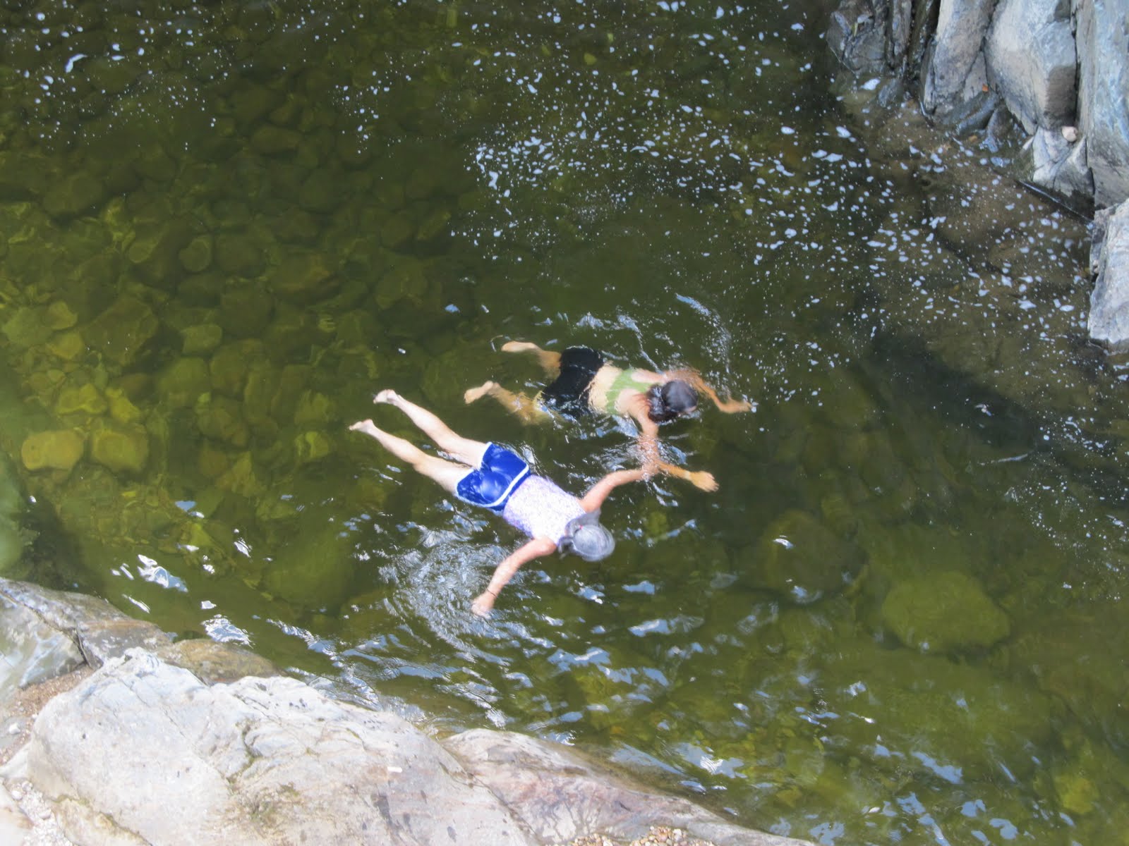 |
| Swimming at the Gorge |
 |
| Crown Point Rd |
When we crossed 103 we ran into a couple of thru-hikers that we had met at Minerva Hinchey shelter. They took the new trail and after a short break when we reached Clarendon shelter the two men strolled down the spur and noticed us with a surprised look . A "when did they pass us?" look. While we were setting up camp, Wayne aka Mad Hatter, the Killington section's president came strolling down the trail. He was to join us for the remainder of the weekend.
 |
| The Mad Hatter joins us. Welcome Mr. President. |
 |
| Home, night one |
This shelter was busy. Thru-hikers came in regularly. Some stayed, some looked around at the tent city and journeyed on. A few slack packers stopped too for a quick break. 22 people stayed at this site to include 14 tents, a hammock and a comfortably filled shelter. (it wasn't packed) By 9:30 pm the place was quiet.
Day two: 10.1 miles
I woke up early and at 4:50 am I had my Pocket Rocket fired up for some coffee and enjoyed the morning twilight. The birds and chipmunks kept me company. Soon the place was awake and busy with packing thru-hikers. By 8:10 the 5 of us along with Prickles hit the trail. Sue would be leaving us at the next road crossing.
 |
| Allison, Sue, Prickles, Kathi, Wayne and me at Clarendon shelter |
From the shelter the trail starts out steep for the first 0.4 climbing 500 feet of elevation. What a great way to get the blood moving for the day. It didn't take long before we reached Lottery Rd and parted ways with Sue. We continued our trek slowly descending before we reached our big up for the day. The heat and humidity was increasing and the wind completely stopped. I was drenched with sweat even though the terrain and descent were fairly easy.

After we crossed Upper Cold River road, we took a break at the "500 miles to Katahdin" sign where Wayne had set up a chair and a cooler of ice sodas and waters the day before. Of course none of the sodas were left but an ice filled bandanna on the neck was soooo wonderful. We continued on towards our lunch stop, Gov. Clement shelter.
 |
| Wayne at Gov Clement shelter |
After a short lunch and a water fill we prepared for our big climb for the day. We still had 4.3 miles with 2000 feet of elevation to go. The heat and humidity were steadily rising. The ground was sweating. We slowed down some but still trekked at a fairly steady pace. Land Shark realized that Kathi didn't have a trailname yet so, since she is vegan I recommended "Chic Pea". It suits her well. This was her first backpacking trip. She had been reading Section Hiker and learning about ultra light backpacking. Her backpack weighed in at 26 pounds with water. Impressive.
 |
| Mad Hatter, Chic Pea and Prickles |
We continued on north as the trail steeply and ruggedly climbs towards the junction of Shrewsbury Peak trail. This was my first time taking this section northerly. I recalled why. We ran into a Long Trail caretaker along the way so I thought I would get a picture of me with her. The GMC had posted on Twitter that the first one to post a pic with a caretaker would win a free T-shirt. I was game. We all got a pic with her. I had met Kim a few weeks back when Kathi and I were day hiking.
 |
| Me and Kim |
As we approached the Shrewsbury Peak trail we came across a small spring that seeped out of the lush moss. I needed water again. And it was ice cold and delicious. At 5:00 pm we reached Shrewsbury Peak trail. I was beat and started to cramp up some because of the days sweat session. Although I drank plenty of water, I had depleted every last electrolyte in my achy body. The worst part of the day was over and after a short break and a refuel of trail mix we headed towards Cooper Lodge; our destination for the day. The sky now was overcast and with elevation came some cooler temps. The trail leveled out some as we well. At 6:00 pm we reached the shelter.
 |
| The tent platform at Cooper Lodge. (photo credit, Allison) |
There were a few people staying but no where as populated as the previous night. The winds finally picked up and the temps dropped as it showed signs of future rain. After a hot dinner, I crawled into my tent when the first drops hit my tent walls. It rained and misted all night and into the next day.
Day three: 5.6 miles
I woke up a 5:00 am to a steady light rain and decided to just lay there and read some. It was too wet for me to make coffee or eat a hot breakfast. I was ready for a hot shower and a decent meal so the parking lot was in mind. I finally climbed out of my warm comfy tent, broke camp in the rain, had a power bar and met the others.
 |
| Tent platforms at Cooper Lodge, morning day three |
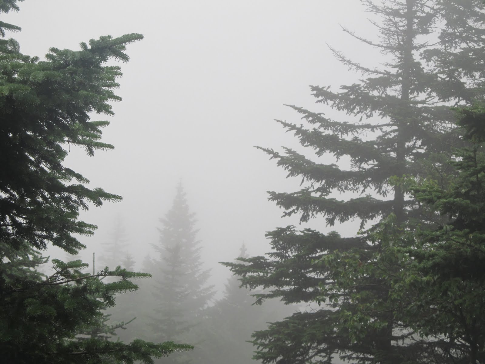 |
| From Cooper Lodge. Wet and foggy. |
It was close to 9:00 by the time we got out of there. My pack, with a wet tent and sweaty laundry weighed in close to 50 pounds. I chose to wear my low cut trail shoes. I set the pace fairly quick. Even though my pack was heavy, my shoes are very sticky on a slippery day. We made it to Jungle Junction by 10:00. 2.5 miles an hour. Since the day before we altered our trip and took the original trail, we did the same when we reached this junction and took Sherburne Pass trail which was the original Long Trail. We continued on north towards Sherburne Pass stopping once at Pico Camp. At 11:50 we reached the parking lot where Allison's husband, Phil, met us with a beer and dry towels. Prickles even indulged. Wayne's wife had met him there as well. Due to the rain I was unable to take any pictures of day three's journey.
 |
| Cheers, Prickles! Thanks for coming along! |
Overall, this was an amazing trip. It was truly an honor to be included in this historic event. Thanks to Allison who coordinated it, Wayne and Sue for sharing their knowledge of history of this wonderful division, Prickles who quietly observed the whole way and especially the GMC; for without them this trail would not be here. Congratulations to Chic Pea for successfully and without fear completing her first backpacking trip. And finally, Happy birthday, Killington Section on your first centennial!
:~)
Monday, August 1, 2011
August: The Countdown Continues
I will not be able to post so therefore I am looking for a few guest posts. I would like to also announce that Tim and Robin Bird of Appalachia and Beyond will be keeping track of my progress and will administrate my blog and Facebook page during the trip. I thought that since the first 105 miles of my thru-hike will be on the Appalachian trail as it coincides with the Long Trail that it would be appropriate to choose them... after all I will be going beyond the Appalachians to Canada.
July was a busy month. The busiest so far this year. My friend Kathi and I entered a 1000 mile challenge and we both are doing very well at it. I managed to hike a total of 66.2 miles and along with walking and kayaking as part of this challenge I managed to tally an impressive 82.5 miles. I also passed my 200th hiking mile for the calendar year in July.

Plans in August include celebrating the GMC's Killington Section 100 birthday on a backpacking trip of the 24 mile division. I have not yet decided if I am going to count this as part of my thru-hike and take a couple of zero days in September. I plan on returning to the Whites and completing my Presidential traverse from Mt Washington to Crawford Notch in a day hike. And of course finishing up my thru-hike logistics.
If anyone is interested in writing a guest post please contact me at jos.minard.sr (at) gmail (dot) com or Tim and Robin at appalachiaandbeyond (at) gmail (dot) com. I would prefer the guest post to be thru-hike or Appalachian/ Long Trail oriented but I will let my guest admin choose what is posted.
I hope everyone has a great month ahead of them.
:~)
Subscribe to:
Posts (Atom)